07:33:04 UTC
|
Wednesday, April 24, 2024
About
About THN
Legal Disclamer
Volunteer Info
Outlooks
Atlantic Cyclone Outlook
Pacific Cyclone Outlook
Advisories
Products
Monthly Tropical Activity Reviews
Public Information Statements
Tsunami
Resources
Hurricane Names
Email Alert System
You are here:
Home
»
Uncategorized
»
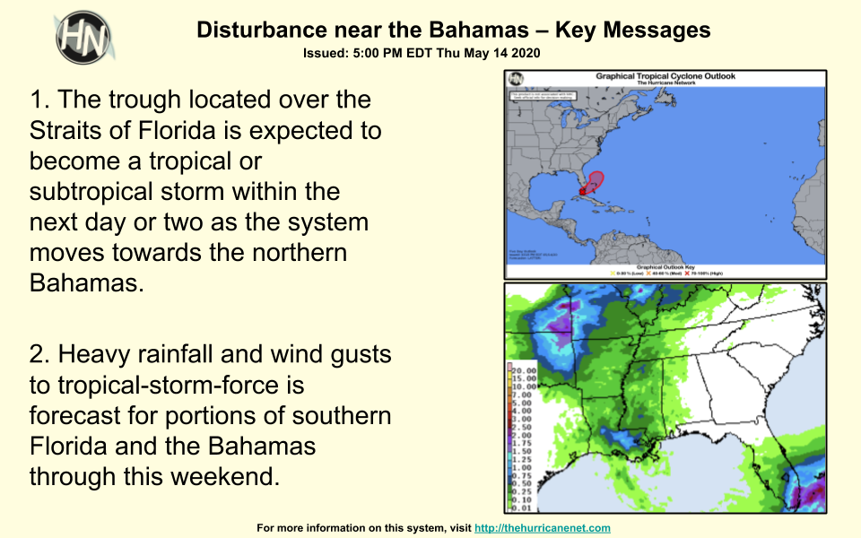
Key messages for Disturbance near the Bahamas
Key messages for Disturbance near the Bahamas
Share this:
Click to share on Twitter (Opens in new window)
Click to share on Facebook (Opens in new window)
Posted in:
Uncategorized
Sponsored Content
© 2023 Hurricane Network Inc., All Rights Reserved
